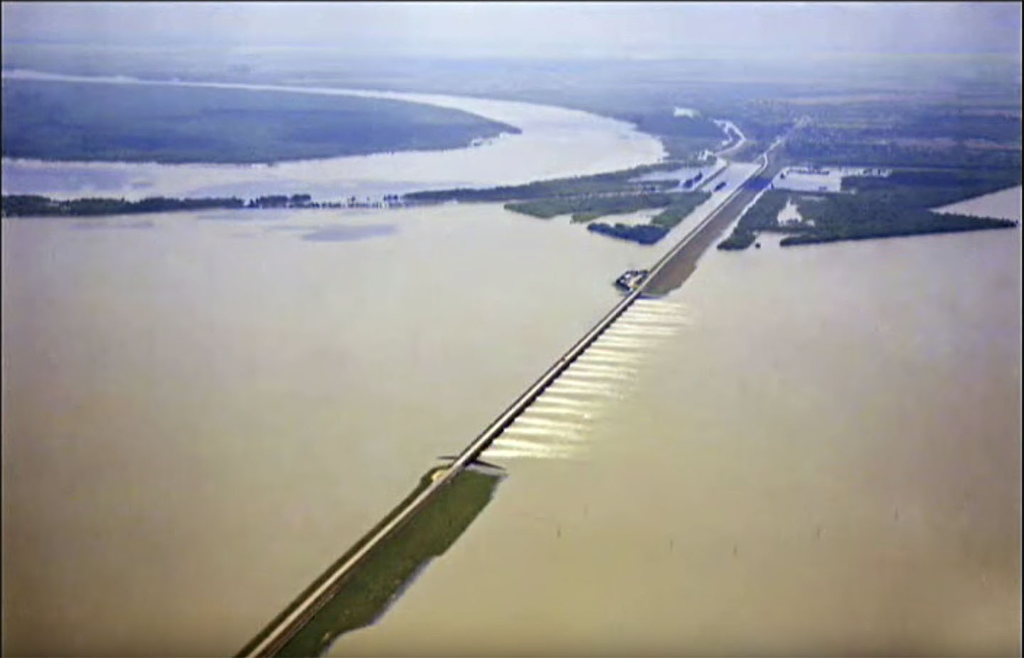
For only the third time, the U.S. Army Corps of Engineers will operate the Morganza Control Structure and Floodway beginning June 6. Operation of Morganza comes as a new crest on the already swollen Mississippi River makes its way toward Louisiana.
Earlier this week, the Corps announced plans to begin operating the structure on June 2. However, on the afternoon of May 30, the agency announced that, due to changes in the forecast, the opening would be put off until June 6.
“The Corps will not put more water into the Atchafalaya Basin than necessary,” the announcement said.
Before that update, the forecast from the National Weather Service called for the Mississippi River at Red River Landing, located at Mile 302.4 above Head of Passes, to exceed 62 feet on June 5. The trigger for operating Morganza is a flow rate of 1.5 million cubic feet per second (cfs.) at Red River Landing, which is 22 miles upriver from Morganza. The Corps does not anticipate exceeding that flow rate. However, the agency fears a stage of 62 feet would overtop the Morganza Control Structure, making it impossible to operate the floodway. To avoid overtopping at the structure and relieve pressure on levees downstream, New Orleans District Commander Michael Clancy sought permission earlier in the week to open the structure.
Under the current forecast, the Corps anticipates diverting about 150,000 cfs. at Morganza into the floodway, which empties into the Atchafalaya River. The Corps is planning a “slow opening” of the structure.
“In accordance with lessons learned during the 2011 historic Mississippi River [flood], USACE will implement a gradual opening of the floodway to minimize impacts to wildlife, particularly the black bear population, and allow federal and state resource agencies to coordinate and implement rescue efforts for various species,” according to a statement from the Corps. “The gradual, or slow opening, allows the Corps to limit elevations in the floodway by adding one foot of water per day for the first three days.”
The June 6 initial opening and press conference for operating Morganza is not open to the public. Louisiana Highway 1, which traverses the spillway near the river, will be closed to vehicular traffic from 10 a.m. to no later than 5 p.m. June 6. For spillway visitors, the Corps urges caution due to the expected displacement of wildlife.
“Do not feed or approach [wildlife],” the Corps said in a May 29 press release. “They have sharp teeth, strong jaws and an ornery disposition.”
Louisiana Gov. John Bel Edwards announced May 29 that President Donald Trump approved his request for a federal disaster declaration in connection with the state’s flood fight, including measures underway to mitigate impacts of Morganza.
“We have been preparing for the opening of the Morganza Spillway by submerging a barge in Bayou Chene to reduce backwater flooding into communities across five parishes,” Edwards said. “This is an important first step, and we stand ready, alongside our federal partners, to support our local leaders in the coming days and weeks, as even more water is expected to make its way to Louisiana.”
The federal disaster declaration includes direct federal assistance at 75 percent federal funding for St. Mary Parish, where the Bayou Chene barge gate is located. The Federal Emergency Management Agency can also assist the parishes of Assumption, Catahoula, Concordia, Iberville, Pointe Coupee, Rapides, St. Landry, St. Martin, Terrebonne and West Feliciana.
The National Weather Service forecasts the gage at Red River Landing will reach 62 feet around June 4 and stay there for two weeks or more, reflecting the anticipated opening of Morganza. In all, Red River Landing has been above flood stage since December 28, 2018—151 days and counting. In all, the “flood fight” on the Lower Mississippi River is nearing an all-time record. Already, rainfall over the past year east of the Rocky Mountains is the most since the National Weather Service began keeping records 124 years ago.
“The current flood fight is historic and unprecedented,” the Corps said in the statement.
As of May 30. the New Orleans District has been in a Phase I flood fight (with the river above 12 feet at the Carrollton Gage) for 217 days. The record length for a Phase 1 flood fight is 225 days, set during the 1973 high water season.
This will be only the third operation of Morganza, with 2011 and 1973 the only prior openings of the structure. Farther downstream, the Bonnet Carré Spillway is in the midst of its second opening this year. At Bonnet Carré, this is the first time the structure has been opened in consecutive years and also the first time it’s been used twice in a single year.
With the river above 15 feet, the Corps is engaged in around-the-clock operations, including daily levee inspections and construction restrictions within 1,500 feet of the crown of the levee.


