The community of Cape St. Claire (CSC), Md., cooperated to plan, fund and perform a shoreline restoration project that will provide coastal protection and wildlife habitat for many years to come. The combination dredging, beach nourishment and habitat creation project was finished at the end of February after years of planning by community representatives, contractors and the Alliance for the Chesapeake Bay.
CSC is an unincorporated community of 8,000 residents near where the Magothy River meets the Chesapeake Bay in Anne Arundel County, Md. The Little Magothy River (LMR), which is 2-1/2 miles long, contains extensive boating and recreational facilities and forms the southeast boundary of the community. A sandy shoreline along Chesapeake Bay forms the eastern boundary. The northwest boundary is Deep Creek, which contains a small beach and marina.
The LMR access is through a 50-foot-wide, 675-foot-long bulkheaded entrance channel. It has a tidal fluctuation of about 2 feet. A 1,100-foot open-water approach channel is maintained at 6 feet in a shallow part of the Chesapeake Bay, and the high quality sand produced by the dredging was the basis of a wider shoreline restoration program the community spent years working toward and completing.
The 1,000-foot-long community beach had eroded to nothing in places, threatening beachfront dwellings. The marina and beach on Deep Creek was severely eroded, while tide-borne sediment regularly made the marina inaccessible.
In 2014, the Cape St. Claire Improvement Association (CSCIA) set about finding a way to mitigate the effects of sea level rise, tides, storms and turbulence from traffic on the nearby Chesapeake Bay Ship Channel, headed by resident Beau Breeden.
In 2015, the group contracted the environmental consulting group Biohabitats Inc. to analyze the natural resources of the area, which included streams, wetlands and shorelines, and to come up with a plan for a project to solve the degradation in the area.
Led by restoration ecologist Joe Berg, Biohabitats identified seven waterfront areas in need of restoration, and the community chose to focus on the two most pressing ones—erosion and degradation at the main beach and restoration of the shoreline at Deep Creek, also called the Lake Claire area.
In January 2016, the CSCIA enlisted the help of the Alliance for the Chesapeake Bay (ACB).
ACB’s mission includes providing collaboration services, project design, funding search and project management for projects designed to prevent pollutants, sediment and nutrients from entering the bay. In its 63,000-square-mile watershed, the Chesapeake Bay is fed by more than 150 major rivers and streams from six states: Delaware, Maryland, New York, Pennsylvania, Virginia and West Virginia, as well as the entire District of Columbia.

The Cape St. Claire project’s potential hundreds of feet of Living Shoreline, marsh creation and wildlife habitat fit the ACB’s mission, and it came on board to help with grant and funding searches and to provide management services to hold and disperse the funds.
“Their team helped hone our grant applicants and act as our general contractor, coordinating contracts with our engineers and construction contractors,” Breeden explained. The ACB takes a small percentage of the funds in payment for its services.
In June 2020, the ACB awarded Biohabitats a design-build contract for the project that includes both areas. Biohabitats hired three sub-contractors: Shoreline Design for the dredging, marine construction and habitat creation; Sustainable Science for help with design and survey; and Ecological Restoration and Management for planting and goose exclusion fencing.
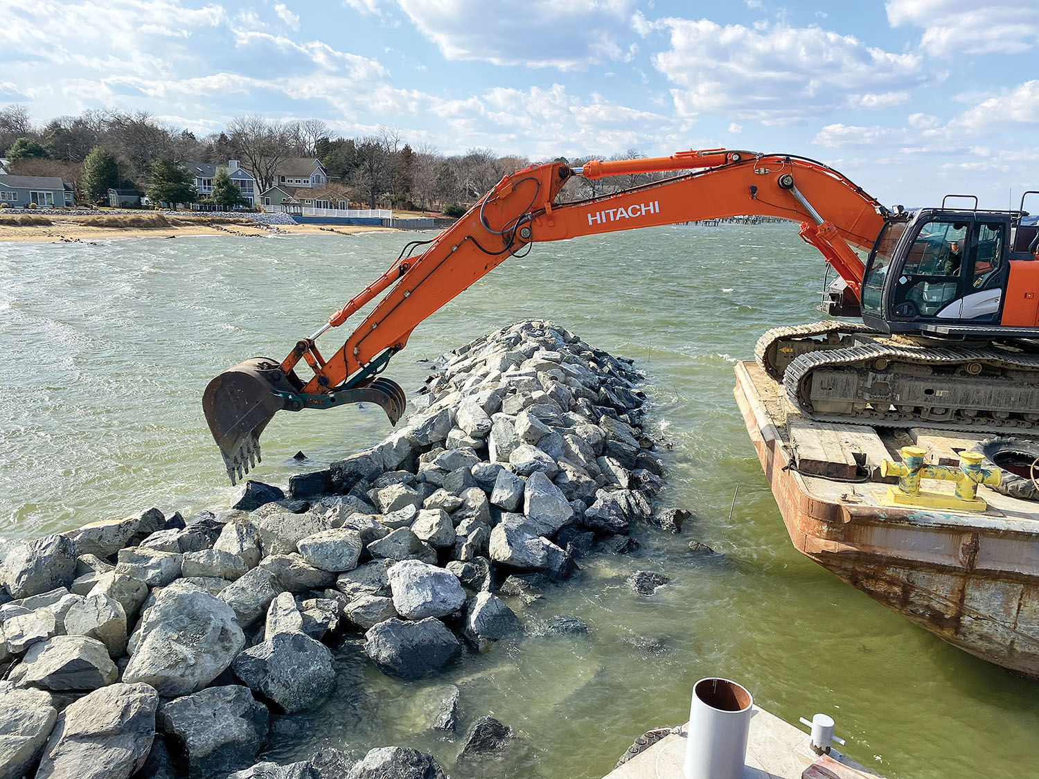
The final permits, planning and contracts were in place by the end of 2020, including from the Maryland Department of the Environment, the U.S. Army Corps of Engineers and Anne Arundel County for construction of the project, beginning with the main beach project (Site 1), followed by the Lake Claire project on Deep Creek (Site 2). Work on Site 1 began in April 2021 with the construction of two headland breakwaters and planting of grasses on the beach for the Living Shoreline.
Sand for the beach restoration was maintenance material from the entrance channel to the Little Magothy River.
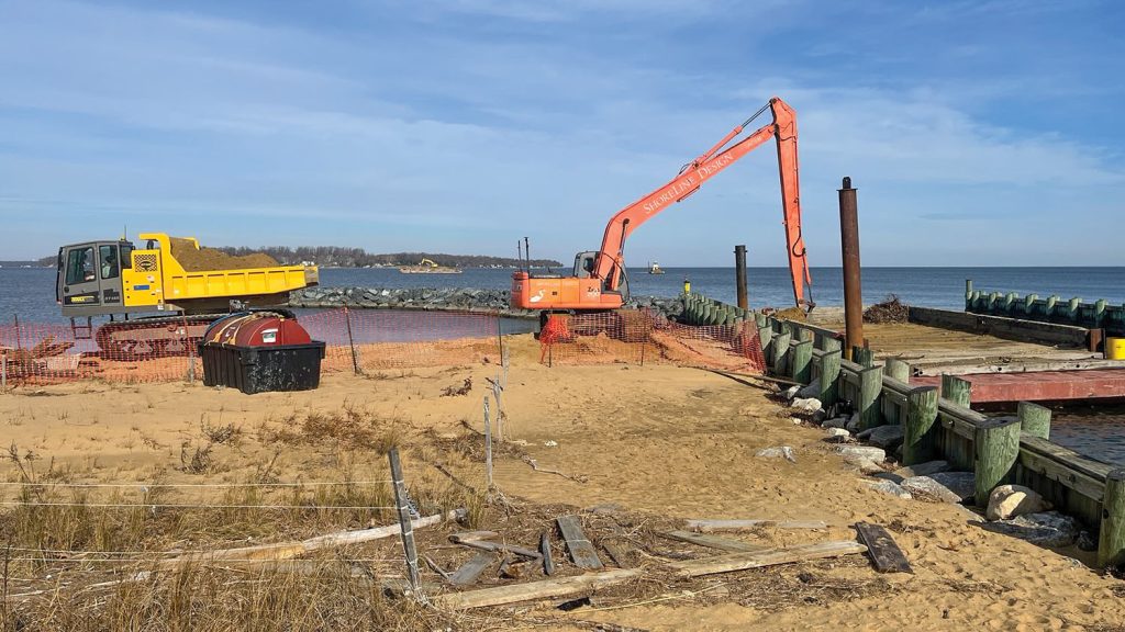
Local litigation delayed the project through the summer of 2021, but by December 20, Shoreline Design’s barge-mounted Hitachi 470 hydraulic excavator was working on the LMR channel, transporting sand by barge to shore and placing it on the beach using a rubber-tracked dump truck for transport to the placement locations for leveling and grading.
Half of the recreational beach—500 feet—is devoted to the Living Shoreline, consisting of wetland plantings to provide wildlife habitat and natural resilience to protect the community, a cost-effective technique for coastal management.

The Ecological Restoration and Management crew planted more than 1,500 marsh grasses on the Living Shoreline in spring 2021 to augment existing dune vegetation.
By the end of January 2022, beach restoration and breakwaters at Site 1 were complete, and Matheu moved his equipment upstream to Site 2, where the crew began setting 40 “root wads” near the shore in the Deep Creek estuary. These are inverted hardwood trees driven 12 feet into the bottom, leaving the washed root ball at the top above and below mean high water to provide shade for fish and other aquatic species as well as perches for sea birds.
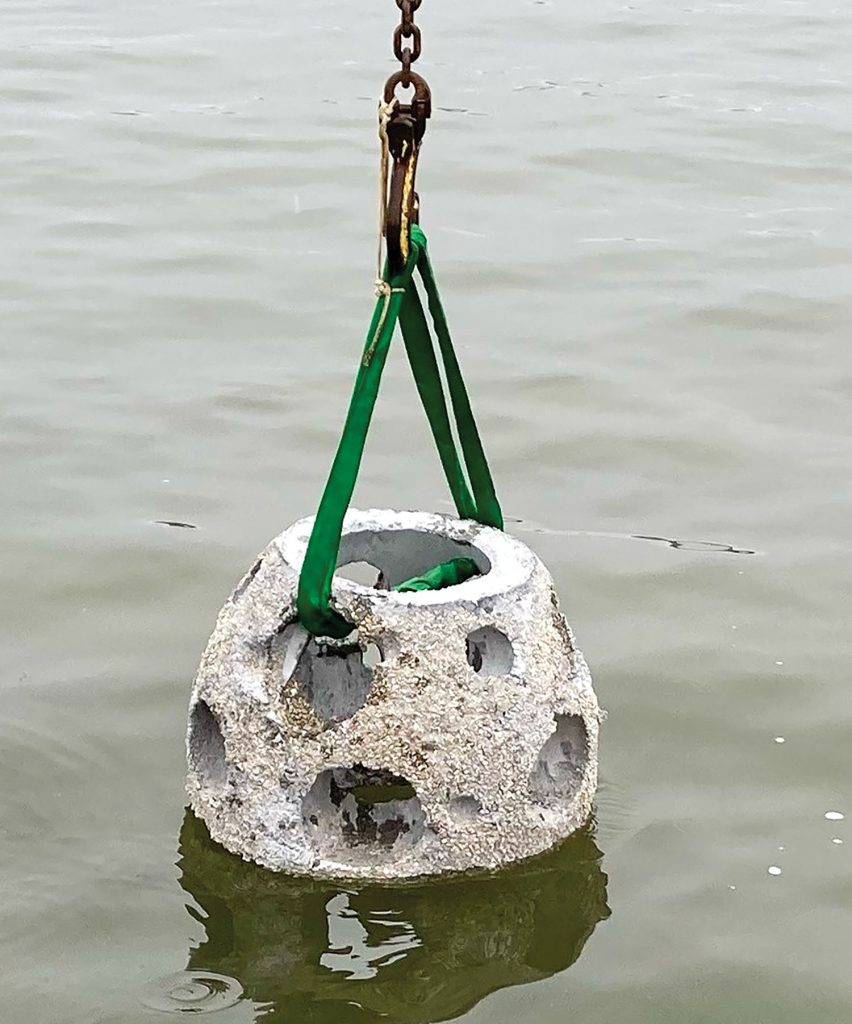
Seaward of the root wads are three groupings of reefballs—a total of 45 hollow domes formed of marine-friendly concrete as the basis of an oyster reef. The domes have holes throughout to allow organisms to access them, and their weight keeps them in place in the low-energy environment of Deep Creek. The tops of the structures are below mean low water and will help form an oyster reef and associated wildlife habitat. Total funding for the project, acquired by the alliance and other involved entities, included: Chesapeake Bay Trust/Anne Arundel County Grant—$298,000; Maryland Bond Bill and PAYGO Capital Grant Funds—$525,000; U.S. Fish & Wildlife Atlantic Coastal Fish Habitat Partnership Grant—$50,000; U.S. Fish & Wildlife North Atlantic Wetlands Conservation Grant—$100,000; Cape St. Claire Improvement Association Inc.—$854,500 over about seven years of cash flow and a loan.
Photos by Wes Matheu, Beau Breeden and Joe Berg.
Caption for top photo: A Shoreline Design excavator places stone on the east breakwater in March 2021. The operator had to choose the best placement for each stone.


